Canada Route
Americas · Canada
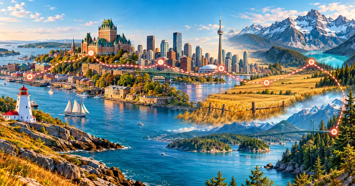
Cross Canada from Montreal to Vancouver. Great lakes, prairies, Rockies, and Pacific forests. This is the exact 4,550 km itinerary currently available in the WalkQuest app, with 16 milestones in this order: Montreal → Ottawa → Kingston → Toronto → Tobermory → South Baymouth → Sault Ste. Marie → Thunder Bay → Winnipeg → Regina → Medicine Hat → Calgary → Banff → Golden → Kelowna → Vancouver. Montreal: A bilingual start of festivals and old stone streets. Montreal is built around Mount Royal. Ottawa: Canada's capital combines Gothic landmarks, museums, and river paths. Ottawa became the capital of the Province of Canada in 1857. Kingston: A limestone city where Lake Ontario meets the Saint Lawrence River. Kingston briefly served as the first capital of the united Province of Canada.
Toronto: Skylines, neighborhoods, and Lake Ontario. Toronto is one of the most multicultural cities in the world. Tobermory: A harbor village of clear water, limestone cliffs, and island ferries. Tobermory is the northern terminus of the Bruce Trail. South Baymouth: The southern gateway to Manitoulin Island beside Lake Huron. The seasonal Chi-Cheemaun ferry links South Baymouth with Tobermory. Sault Ste. Marie: A Great Lakes city beside the rapids joining Superior and Huron. The Sault locks allow vessels to bypass the St. Marys River rapids.
The journey finishes at Vancouver after 4,550 km. Distances and milestone counts on this page are generated from the same route catalog used by the app, so the guide matches the experience users unlock. Canada Route is a 4,550 km virtual walking journey across Canada. The itinerary connects Montreal, Ottawa, Kingston, Toronto, using real geography and documented heritage to turn daily movement into a clear long-term adventure. Montreal, Ottawa, Kingston are among the route's defining chapters. At 10,000 steps per day, the full distance is designed to take about 35 weeks, so progress grows through steady routines rather than one intense effort. Each milestone unlocks concise historical, cultural and landscape context, while digital stamps make the scale visible. Walk anywhere that is safe and convenient: Health Connect steps advance the virtual map even when the real-world route includes sea crossings, high mountains or long transfers.
Highlights
- ✓Explore Montreal, Ottawa through Vancouver
- ✓4,550 km · 35 weeks at 10,000 steps/day
- ✓Route: Canada
- ✓Landmarks: Montreal, Ottawa, Kingston
- ✓Cities and milestones: Kingston, Toronto, Tobermory, South Baymouth
- ✓Collectible stamps: 16
Cities and milestones
Montreal
Canada
A bilingual start of festivals and old stone streets. Montreal is built around Mount Royal.
Ottawa
Canada
Canada's capital combines Gothic landmarks, museums, and river paths. Ottawa became the capital of the Province of Canada in 1857.
Kingston
Canada
A limestone city where Lake Ontario meets the Saint Lawrence River. Kingston briefly served as the first capital of the united Province of Canada.
Toronto
Canada
Skylines, neighborhoods, and Lake Ontario. Toronto is one of the most multicultural cities in the world.
Tobermory
Canada
A harbor village of clear water, limestone cliffs, and island ferries. Tobermory is the northern terminus of the Bruce Trail.
South Baymouth
Canada
The southern gateway to Manitoulin Island beside Lake Huron. The seasonal Chi-Cheemaun ferry links South Baymouth with Tobermory.
Sault Ste. Marie
Canada
A Great Lakes city beside the rapids joining Superior and Huron. The Sault locks allow vessels to bypass the St. Marys River rapids.
Thunder Bay
Canada
A Lake Superior port framed by boreal forest and the Sleeping Giant. Thunder Bay was formed by the merger of Fort William and Port Arthur.
Winnipeg
Canada
Prairie skies and river meeting points. Winnipeg is known as the Gateway to the West.
Regina
Canada
A prairie capital of broad skies, parks, museums, and civic landmarks. Regina was named in honor of Queen Victoria.
Medicine Hat
Canada
A sunny prairie city shaped by clay, natural gas, and river coulees. Medicine Hat became known for industries powered by abundant natural gas.
Calgary
Canada
Foothills, rodeo spirit, and mountain access. Calgary is close to Banff National Park.
Banff
Canada
A mountain town surrounded by the peaks and lakes of Banff National Park. Banff National Park was Canada's first national park.
Golden
Canada
A mountain railway town near six Canadian national parks. Golden stands where the Kicking Horse and Columbia rivers meet.
Kelowna
Canada
An Okanagan Valley city of orchards, vineyards, beaches, and lake views. Kelowna sits on the eastern shore of Okanagan Lake.
Vancouver
Canada
Finish between ocean, forests, and peaks. Vancouver has one of North Americas largest urban parks.
Landmarks
Montreal
A bilingual start of festivals and old stone streets. Montreal is built around Mount Royal.
Ottawa
Canada's capital combines Gothic landmarks, museums, and river paths. Ottawa became the capital of the Province of Canada in 1857.
Kingston
A limestone city where Lake Ontario meets the Saint Lawrence River. Kingston briefly served as the first capital of the united Province of Canada.
Toronto
Skylines, neighborhoods, and Lake Ontario. Toronto is one of the most multicultural cities in the world.
Tobermory
A harbor village of clear water, limestone cliffs, and island ferries. Tobermory is the northern terminus of the Bruce Trail.
South Baymouth
The southern gateway to Manitoulin Island beside Lake Huron. The seasonal Chi-Cheemaun ferry links South Baymouth with Tobermory.
Fact sources
Hero image: AI-generated original artwork by OpenAI for WalkQuest.
Related routes
Open in WalkQuest
Explore Canada Route, a 4,550 km virtual walking route with real cities, landmarks and collectible stamps. Start your WalkQuest journey today.