Patagonia Wilderness
Americas · Argentina · Chile
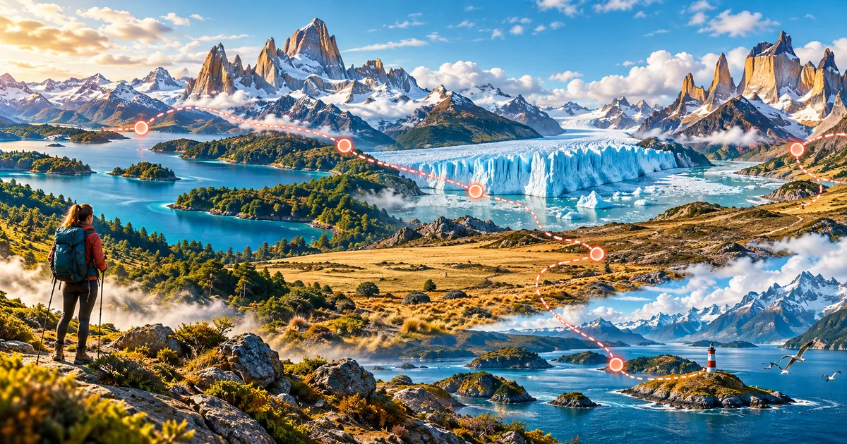
Cross glacier country, granite peaks, lakes, and windswept wilderness. Granite towers, blue ice, and untamed horizons. This is the exact 450 km itinerary currently available in the WalkQuest app, with 6 milestones in this order: Bariloche Lake District → Mount Fitz Roy → Perito Moreno Glacier → Torres del Paine → Grey Glacier → Tierra del Fuego. Bariloche Lake District: Begin among blue lakes and forested Andean ridges. Bariloche sits within Argentina’s oldest national park. Mount Fitz Roy: Approach sharp granite towers above El Chalten. Fitz Roy’s Tehuelche name, Chalten, means smoking mountain. Perito Moreno Glacier: Walk beside a wall of blue ice advancing into the lake.
The glacier is famous for periodic ice-bridge ruptures. Torres del Paine: Enter a park of granite towers, steppe, and turquoise lakes. The three granite towers are among Patagonia’s defining landmarks. Grey Glacier: Follow floating ice toward the Southern Patagonian Ice Field. Grey Glacier is part of one of the largest ice fields outside the polar regions. Tierra del Fuego: Finish where forested mountains meet the Beagle Channel. The archipelago’s name dates to fires observed by early European sailors. The journey finishes at Tierra del Fuego after 450 km.
Distances and milestone counts on this page are generated from the same route catalog used by the app, so the guide matches the experience users unlock. Patagonia Wilderness is a 450 km virtual walking journey across Argentina, Chile. The itinerary connects Bariloche Lake District, Mount Fitz Roy, Perito Moreno Glacier, Torres del Paine, using real geography and documented heritage to turn daily movement into a clear long-term adventure. Bariloche Lake District, Mount Fitz Roy, Perito Moreno Glacier are among the route's defining chapters. At 10,000 steps per day, the full distance is designed to take about 10 weeks, so progress grows through steady routines rather than one intense effort. Each milestone unlocks concise historical, cultural and landscape context, while digital stamps make the scale visible. Walk anywhere that is safe and convenient: Health Connect steps advance the virtual map even when the real-world route includes sea crossings, high mountains or long transfers.
Highlights
- ✓Explore Bariloche Lake District, Mount Fitz Roy through Tierra del Fuego
- ✓450 km · 10 weeks at 10,000 steps/day
- ✓Route: Argentina, Chile
- ✓Landmarks: Bariloche Lake District, Mount Fitz Roy, Perito Moreno Glacier
- ✓Cities and milestones: Perito Moreno Glacier, Torres del Paine, Grey Glacier, Tierra del Fuego
- ✓Collectible stamps: 6
Cities and milestones
Bariloche Lake District
Argentina
Begin among blue lakes and forested Andean ridges. Bariloche sits within Argentina’s oldest national park.
Mount Fitz Roy
Argentina
Approach sharp granite towers above El Chalten. Fitz Roy’s Tehuelche name, Chalten, means smoking mountain.
Perito Moreno Glacier
Argentina
Walk beside a wall of blue ice advancing into the lake. The glacier is famous for periodic ice-bridge ruptures.
Torres del Paine
Chile
Enter a park of granite towers, steppe, and turquoise lakes. The three granite towers are among Patagonia’s defining landmarks.
Grey Glacier
Chile
Follow floating ice toward the Southern Patagonian Ice Field. Grey Glacier is part of one of the largest ice fields outside the polar regions.
Tierra del Fuego
Argentina
Finish where forested mountains meet the Beagle Channel. The archipelago’s name dates to fires observed by early European sailors.
Landmarks
Bariloche Lake District
Begin among blue lakes and forested Andean ridges. Bariloche sits within Argentina’s oldest national park.
Mount Fitz Roy
Approach sharp granite towers above El Chalten. Fitz Roy’s Tehuelche name, Chalten, means smoking mountain.
Perito Moreno Glacier
Walk beside a wall of blue ice advancing into the lake. The glacier is famous for periodic ice-bridge ruptures.
Torres del Paine
Enter a park of granite towers, steppe, and turquoise lakes. The three granite towers are among Patagonia’s defining landmarks.
Grey Glacier
Follow floating ice toward the Southern Patagonian Ice Field. Grey Glacier is part of one of the largest ice fields outside the polar regions.
Tierra del Fuego
Finish where forested mountains meet the Beagle Channel. The archipelago’s name dates to fires observed by early European sailors.
Fact sources
Hero image: AI-generated original artwork by OpenAI for WalkQuest.
Related routes

Open in WalkQuest
Explore Patagonia Wilderness, a 450 km virtual walking route with real cities, landmarks and collectible stamps. Start your WalkQuest journey today.